CRUISE NAME:MTPII-MATER/M3BN-MAR98 IDENTIFIER: GN36199804612 Ship Name: R/V AEGAEO Call Sign: SXYY Ship Type: Research Vessel PROJECT: MASTIII-MTPII-MATER Scientific Coordinating Body: NCMR, Athens, Greece |
Chiefs Scientist(s) (3 max, for further information, see further with ROSCOP parameters :
| A) : Dr. Anastasios Tselepides |
| Laboratory : Institute of Marine Biology of Crete (IMBC) |
| Address : P.O. Box 2214, 71003 Iraklion, Crete, Greece |
| Tel : ++ 30 81 242022 |
| Fax : ++ 30 81 241882 |
| Email : ttse@imbc.gr |
Other Participating Bodies : (Scientist Name, Institute Name, Country)
B) Dr. Gerard Duineveld, NIOZ, Texel, The Netherlands
C) Dr. Panos Drakopoulos, IMBC, Iraklion, Crete, Greece
D) Dr. Leon Moodley, NIOO, Centre of Estuarine and Coastal Ecology, Yerseke, The Netherlands
E) Olivier Tholosan, LMM, CNRS, Marseille, France
F) Daniella Marrale, ISAM, Universita di Genova, Genova, Italy
Objectives:
This was the third cruise of the project MATER (MAss Transfer and Ecosystem Response) that concentrated on the study of the benthic environment at the selected stations of the South and North Aegean Sea.
The main tasks involved:
- collecting sediment samples with an 0.25 m2 USNEL Boxcorer and a Bowers/Connely multicorer from 3 stations in the South (MSB1, 2, 3) and 7 stations in the North Aegean Sea (MNB1, 2, 3, 4, 6, 8, 9) for determining the:
- deploying the NIOZ's benthic lander, BOLAS, to obtain in situ SCOC (sediment community oxygen consumption) measurements, to video record and identify potential scavengers attracted to the attached baited traps.
Cruise Period Start : 21/03/98 End : 04/04/98
Port of Departure : Heraklion, Crete, Greece Port of Return : Heraklion, Crete, Greece
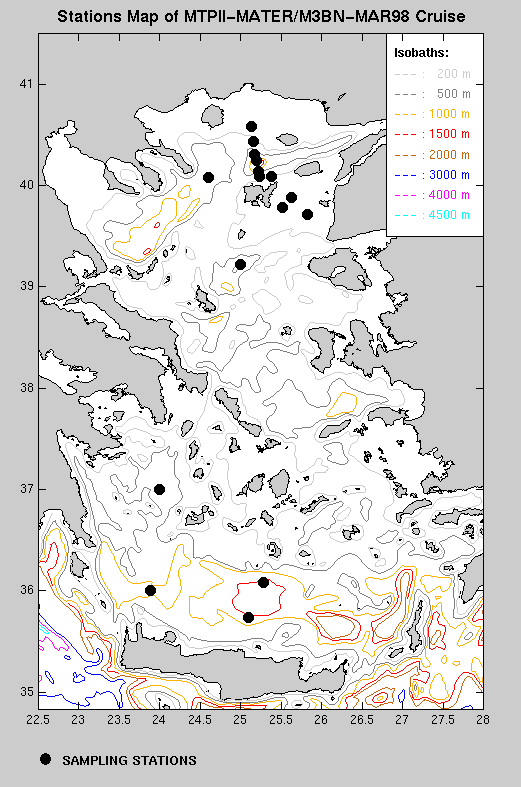
SEA/OCEAN : Coded Region(list below) : Med. Eastern Basin Local Name: Aegean Sea
Geographical Limits
| North : | N40 34.70 | South : N35 44.70 | ||
| West : | E025 35.47 | East : E023 53.70 |
Description of the field observations :
STATIONS LOCATION AND TYPE OF MEASUREMENTS
| STATION | DATE | TIME GMT | LATITUDE | LONGITUDE | TYPE CODE (ROSCOP) |
|---|---|---|---|---|---|
25/03/98 up 13:15 up | |||||
25 10.61 | |||||
25 10.49 | |||||
20:40-21:55 40 04.82 24 36.50 G04b, B02b, B90b | |||||
24 36.38 G04b, B18b | |||||
24 36.41 | |||||
24 36.47 | |||||
| | | ||||
| | | ||||
G08, B73, B90c | |||||
25 07.87 | |||||
25 07.96 | |||||
25 07.87 | |||||
29/03/98 | |||||
B90b | |||||
H10 | |||||
H10 | |||||
H10 | |||||
02/04/98 up 16:00 up | |||||
36 04.45 | |||||
04/04/98 up 08:45 up | |||||
03/04/98 | |||||
| | |||||
| | |||||
25 06.33 | |||||
25 07.30 | |||||
25 07.30 |
DISCIPLINES
| CODE | DISCIPLINES |
|---|---|
| MARINE BIOLOGY & FISHERIES | |
| CHEMICAL OCEANOGRAPHY (Hydrology) | |
| GEOLOGY & GEOPHYSICS | |
| PHYSICAL OCEANOGRAPHY (Hydrology) | |
IOC MEDITERRANEAN REGIONS
| IOC REGION | CODE |
|---|---|
BIBLIOGRAPHICAL REFERENCES (DATA REPORTS) :
| CODE | PARAMETER | MEASUREMENT DESCRIPTION | Nb Obs. | Scientist |
|---|---|---|---|---|
| B02 | Phytoplankton pigments | a. Sediment cores were sliced in 5 depth layers (0-3, 3-10, 10-20, 20-40, 40-60 mm) and stored at -20oC for later analyses of Chla and phaeopigment concentrations | 10 | A |
| b. Sediment surface slices were deep frozen in liquid nitrogen, freeze dried and stored at -80oC for later phytopigment analyses by means of HPLC | 10 | B | ||
| B16 | Benthic bacteria/micro-organisms | Sediment cores were sliced in 3 depth layers (0-2, 2-4, 4-6 cm), processed and analysed immediately on board to determine proteolytic and respiration rates. Samples were also preserved for later determination of bacterial abundance | 8 | E |
| B18 | Zoobenthos | a. Sediment cores were sliced in 4 depth layers (0-1, 1-2, 2-4, 4-6 cm) and preserved for later analysis of the benthic meiofauna | 10 | F |
| b. Sediment cores were sliced in 3 depth layers (0-5, 5-10, 10-20 cm), sieved over a 0.5mm mesh and preserved in formalin for later analysis of the benthic macrofauna | 10 | A | ||
| c. Sediment cores were sliced in 1 cm slices down to 6 or 15 cm and preserved for later analysis of benthic foraminifera | 8 | D | ||
| B72 | Biochemical meas. | Sediment cores were sliced in 5 depth layers (0-3, 3-10, 10-20, 20-40, 40-60 mm) and stored at -20oC for later analyses of LOM (carbohydrates, lipids, proteins) | 10 | F |
| B73 | Sediment traps | Sediment traps PPS3 were attached onto the BOLAS lander and deployed for approximately 17-44 hours | 4 | B |
| B90 | Other biological/fisheries meas. | a.Sediment cores were sliced into 5 depth layers (0-3, 3-10, 10-20, 20-40, 40-60 mm) and used for the analysis of ATP | 8 | A |
| b.Sediment cores were used to determine the nutrient release rate through incubation experiments | 7 | B | ||
| c. In situ measurements of O2 were conducted with the benthic lander (BOLAS) in order to determine the Sediment Community Oxygen Consumption (SCOC) | 4 | B | ||
| G04 | Core soft bottom | A 0.1m2 USNEL boxcorer (b) and a BOWERS/CONNELY multicorer (a) were used to collect sediment samples for the parameters: B02 (a,b), B16, B18 (a,b,c), B72, H22, H24, H25, H26, H75 | 8(a) | A |
| G08 | Bottom photography | Video recordings of the sea floor were obtained from a camera mounted onto the benthic lander (BOLAS) | 4 | B |
| H09 | Water bottle stations | Water samples were collected from various depths with Niskin water bottles during CTD casts for the analyses of chloroplastic pigments (B02c) | B | |
| H10 | CTD stations | CTD casts were conducted for hydrographic recordings and collection of water samples | 15 | C |
| H22 | Phosphate | Near bottom water was collected from the multi-corer and stored at -20oC until further analyses of phosphate | 8 | A |
| H24 | Nitrate | Near bottom water was collected from the multi-corer and stored at -20oC until further analyses of nitrate | 8 | A |
| H25 | Nitrite | Near bottom water was collected from the multi-corer and stored at -20oC until further analyses of nitrite | 8 | A |
| H26 | Silicate | Near bottom water was collected from the multi-corer and stored at -20oC until further analyses of silicate | 8 | A |
| H75 | Total - N | Sediment cores were sliced in 5 depth layers (0-3, 3-10, 10-20, 20-40, 40-60 mm) and stored at -20oC for later analyses of TON and TOC | 10 | A |
| H76 | Ammonia | Near bottom water was collected from the multi-corer and stored at -20oC until further analyses of ammonia | 8 | A |